


Description
Precision Mapping, Simplified Workflow & Exclusive Savings

-
-
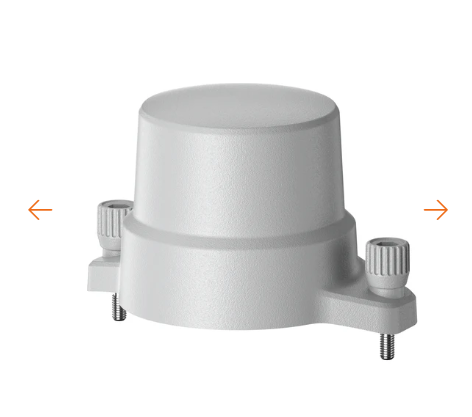
Centimeter-Level Accuracy Without a Base Station
Multi-GNSS (GPS/Galileo/BeiDou) and Network RTK deliver real-time centimeter positioning, eliminating the need for external base stations and streamlining large-area mapping.
-
Smart Software Integration for Rapid Results
Seamless compatibility with Autel Mapper enables instant 2D/3D model.
-
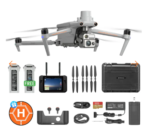
Save $229 With RTK Module Bundle
229USD discount compared to purchasing separately—maximize value without compromising precision.
-
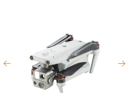
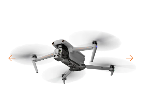
Autel EVO Max 4T – A Leader of Drone Intelligence
The EVO Max 4T brings powerful technologies and advanced autonomy to users. EVO Max 4T assesses complex environments to create real-time 3D flight paths for unparalleled obstacle avoidance.Advanced sensors make flight in GPS unavailable areas possible and the incredible new thermal payload unlocks new object identification and tracking scenarios.With a foldable, weather-resistant design, the EVO Max 4T is as portable as it is capable.


15s
Take Off
8K 10x
Optical Zoom
IP43
Weather Rating
Hot-Swappable
Batteries
Navigation
In GPS Denied Environments
12.4 miles
Transmission Range
42 Minutes
Flight Time
720°
Obstacle Avoidance
-
Autel Autonomy
EVO Max 4T is the only commercial drone that combines traditional binocular vision systems with millimeter wave radar technology. This allows the EVO Max 4T’s onboard Autel Autonomy Engine to perceive objects down to 0.5 inch, eliminating blind spots and enabling operation in low light or rainy conditions.

Binocular Vision System 
Millimeter Wave Radar
-
-
Autonomous Path Finding Autel’s Autonomy Engine collects surrounding environmental data and plans 3D flight paths through complex environments such as mountains, forests, and buildings. Use cases include rapid 3D scene reconstruction, public safety overwatch, industrial inspection, and land surveying.

-
-
-
Navigation in GPS Denied Environment Advanced sensors allow the EVO Max 4T to navigate within hardened structures, underground, or in environments without GPS.

-
-
-
Accurate Object Identification and Tracking Based on Autel’s AI recognition technology, the EVO Max 4T can automatically identify and lock onto different types of targets such as heat sources, moving people, or vehicles and achieve high-altitude tracking and data collection for law enforcement.

-
No Blind Spots
Ultimate Obstacle Avoidance
EVO Max 4T is the only commercial drone that combines traditional binocular vision systems with millimeter wave radar technology. This allows the EVO Max 4T’s onboard Autel Autonomy Engine to perceive objects down to 0.5 inch, eliminating blind spots and enabling operation in low light or rainy conditions.
-
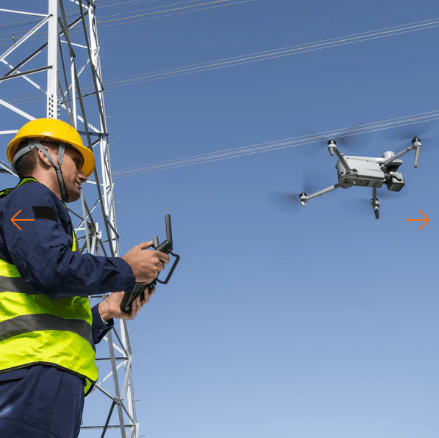
Anti Jam, Anti Interference
The EVO Max 4T uses advanced flight control modules and algorithms specially designed to counter RFI, EMI, and GPS spoofing. This enables the EVO Max 4T to fly confidently near power lines, critical structures, and in complex areas.

-
Weather Rating-IP43
Autel EVO Max 4T with IP43 Ingress Protection rating, it means Max 4T is protected against solid objects greater than 1mm and against sprays of water up to 60 degrees from the vertical.
Operation Temperature
-4 ℉ to 122 ℉
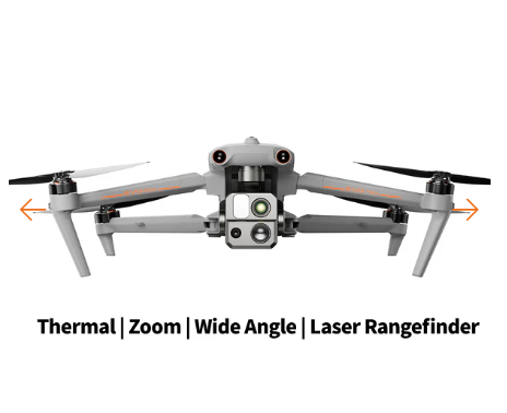
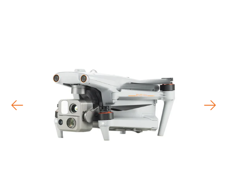
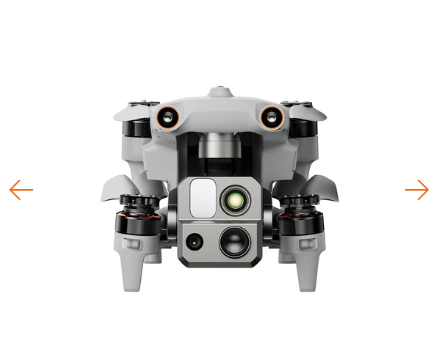
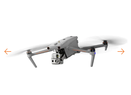
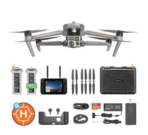
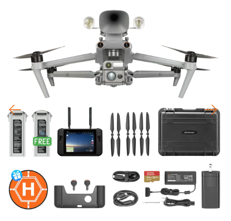
4T Xe Mission Ready Payload
Autel Max 4T Xe gimbal camera system combines a wide-angle camera, zoom camera, thermal camera, and a laser rangefinder, offering a comprehensive solution for data capture across a variety of environments. This versatile payload is designed to excel in multiple application scenarios, enabling precise decision-making and ensuring optimal performance under diverse conditions.

- 640*512 resolution
- 9.1 mm focal length
- 16x digital zoom
- Range: -4℉ to 1.22 ℉
- Temperature accuracy: ±2℃ or reading 2℃
Chase the Heat and Explore the Night
-
-
Super Zoom
The zoom camera supports 8K 10x continuous optical zoom and a maximum hybrid zoom of up to 160x, making vehicles and ships visible up to 2 kilometers away.
Operators do not need to go to the scene, thereby improving work efficiency and ensuring the safety of personnel and flight equipment. This efficient capability empowers applications in energy inspections, emergency rescue, and public safety and security industries.
-
-
-
Super-sensitive Imaging
Video: Capable of recording up to 4K 30p extreme low-light videos, with ISO reaching up to 64000. Even in moonlight conditions, it can capture target details.
Photography: Supports intelligent hardware multi-frame noise reduction and HDR fusion technology, ensuring delicate and clear photos in low-light environments.
-
-
-
Superior Infrared
The zoom camera supports 8K 10x continuous optical zoom and a maximum hybrid zoom of up to 160x, making vehicles and ships visible up to 2 kilometers away.
Operators do not need to go to the scene, thereby improving work efficiency and ensuring the safety of personnel and flight equipment. This efficient capability empowers applications in energy inspections, emergency rescue, and public safety and security industries.
-
-
-
Precision Ranging
One-click pinpoint positioning enables rapid acquisition of target location, with a maximum ranging distance of up to 1.2 kilometers.
-
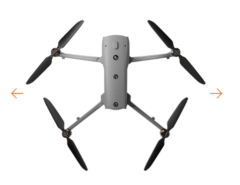
Platform Capability
EVO Max 4T redefines portability with its robust performance and all-weather design, making it the ideal choice for versatile aerial operations. It boasts an impressive 42 minutes of maximum flight time, a top horizontal speed of 23 m/s, and an image transmission range of up to 12.4 miles.
-
42 mins Max. Flight Time -
23m/s Max. Horizontal Speed -
12.4 miles Image Transmission Range -
27 mph* Max. Wind Resistance

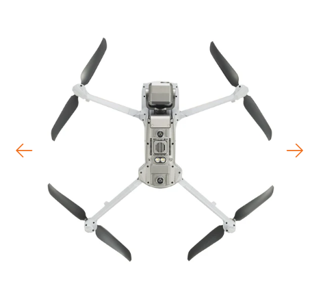
Hot-Swappable Battery
Autel Max 4T hot-swappable battery system, which allows for extended flight times without the need for downtime. This system allows users to easily swap out batteries while the drone is still in operation, making it ideal for use in time-critical applications where every second counts.
-
-
8070 mAh Capacity
-
14.88V Voltage
-
LiPo 4S Battery Type
-
120wh Energy
-
520g Net Weight
-
Support Hot Swap
-

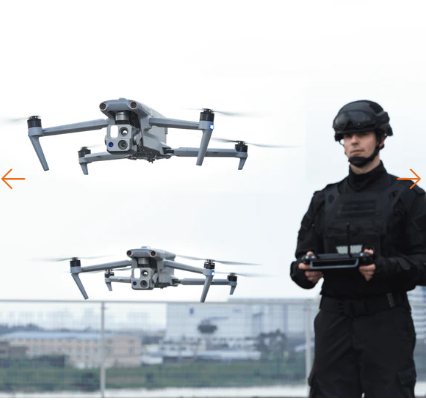
A-Mesh Networking Solution
Autel EVO Max 4T introduces the innovative A-Mesh system, enabling seamless drone-to-drone autonomous communication, connection, and collaboration. Unlike traditional communication chains, the system ensures continuous data relay, even if a single drone fails or disconnects, thanks to its strong anti-interference capabilities.

Zonal operations
Autel EVO Max 4T supports dual-drone dual-control to achieve zonal operations of aircraft, improving flight work efficiency. It also supports mutual obstacle avoidance among drones within the network, ensuring flight operation safety.

Information sharing
The two remote controllers within the network can simultaneously monitor the aircraft footage. The AI target recognition feature used in the lead controller can also be displayed on the member controller. Additionally, both controllers can utilize the pinpoint positioning feature.

Relay operations
In scenarios with signal obstructions or weak signals such as crossing hills or remote areas, the aircraft can be quickly deployed as a mobile relay communication node, providing reliable signal support for another member aircraft at a distance, efficiently expanding the communication coverage area.
Autel SkyLink 3.0
Autel Max 4T SkyLink 3.0 system is a highly advanced drone communication technology, offering impressive specifications for enhanced flight performance. Here’s a summary of its key features:
-
12.4 miles Image Transmission Distance -
<150ms Latency -
1080p/60fps Real-Time Image Quality -
900MHz/2.4GHz/5.2GHz/5.8GHz** Frequency Bands

This feature will be available in a future update. **5.2GHz is only applicable for FCC, CE, and UKCA regions. 900MHz is only applicable for FCC regions.
Autel Enterprise App Platform
The Autel Enterprise App is built from the ground up for industrial applications and features a brand-new interface for simple, efficient operation. Additional features and semi-autonomous modes maximize the EVO Max 4T’s mission capability.

Smart Features
-

-
3D Map Planning Plan, create, and execute 3D waypoint mission plan on a 3D map.
-

-
Quick Mission* Temporary quick missions can be created while executing other missions, and multiple sub-missions can be stacked for enhanced flexibility.
-

-
Mission Reproduction* With this feature activated, fly a manual or semi-autonomous mission, or string multiple missions together. The EVO Max4T will automatically record the camera angles and replicate the mission you just flew.
Multiple Mission Types
The Enterprise App provides various autonomous and semi autonomous mission planning for public safety, inspection, and surveying.

Automatic Mission Generation And Data Capture*
Automatically produce routes by adding regional boundary points through dots or importing KML files

Polygon Mission
Supports one-click automatic generation of polygon flight areas

Waypoint Missions
Users can add waypointsfor flexible, non-structured flight paths
Data Security
Privacy Protection: Data involving user and aircraft information, including flight logs, locations, and account information can only be physically accessed via the aircraft locally.
Encrypted Data Storage: Supports AES-256 encryption for photos, videos, and flight logs, are password-protected.

Autel SDK
The Autel SDK is open to the world, helping developers and partners reduce software and hardware development costs and jointly create a new industry ecosystem.

-

Mobile SDK - Open UX SDK (iOS/Android) can directly call up the ready-made interactive interface.


Valoraciones
No hay valoraciones aún.